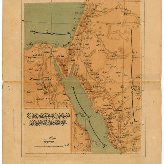
Ottoman road and rail map of the Hejaz
Celail-i asar-i seniyye-i hazret-i Hilafet-penahi'den Hamidiye Hicaz Demiryolunu irae eder haritadir [Map of the Hamidiye (cavalry) Hejaz Railroad].
No place, ca. 1910.
Lithographed map in colour. 139 x 177 mm on 180 x 219 mm (sheet). Scale 1:11,500,000.
$670.00
Rare Ottoman road and rail map of the Hejaz, produced shortly before the First World War, including the Sinai Peninsula, parts of Egypt, the Red Sea, and the Mediterranean. Roads and rail transportation ways are indicated in detail. It shows the Hejaz Railway with tracks running as far south as Medina and various projected but never-realized extensions southwards to Mecca. The map also indicates Egyptian railway routes from Alexandria, Damiette and Port Said southward.
Horizontal tear repaired on the verso with archival tape. A rare survival.
Related
-
Voyage de la Propontide et du Pont-Euxin.Paris, 1800-1802.
$3,910.00 -
Voyage en Arabie & en d'autres Pays circonvoisins. Tome premier (-second). …Amsterdam & Utrecht, 1775-1780.
$6,702.00 -
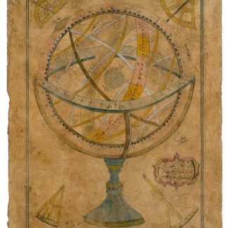
Zâtü'l-Kürsü. Autograph drawing signed.Probably Istanbul, ca. 1732.
$10,612.00 -
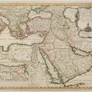
Estats de L'Empire du Grand Seigneur des Turqs ou Sultan des Ottomans en …Paris, 1654.
$2,793.00