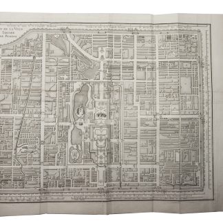
A description of Beijing, with six accurate plans
Description de la ville Peking, pour servir à l'intelligence du plan de cette ville, gravé par les soins de M. de l'Isle.
4to. (2), 44, (1) pp. With woodcut vignette on title-page, and 6 engraved folding plans (16 x 12 to 23.5 x 25 cm). 19th century half sheepskin, marbled endpapers.
€ 18,000.00
First edition of a description of Beijing, illustrated with six accurate plans. The French cartographer and astronomer Joseph-Nicolas de L'isle (1688-1768) had been corresponding about Chinese astronomy and geography with Jesuit missionaries for more than 30 years, collecting a vast amount of valuable information. The Jesuit father Patouillet asked him to compose a map of Beijing, based on these memoirs, to illustrate a description of the city he was preparing. Unfortunately, Patouillet was unable to complete his description, and De L'isle, assisted by the French astronomer and geographer Alexandre Guy Pingré (1711-96), continued and finished it. Astronomical observations helped them to determine the position of Beijing. The work starts with a description of the foundation of the city, the palace, other buildings and the suburbs, followed by some observations on the Li, also called the Chinese mile: the traditional Chinese unit of distance.
Some leaves slightly browned, some spots throughout and one plate with a small tear in the margin just touching the image. Binding slightly rubbed along the corners. A good copy, only slightly trimmed.
Cordier (Sinica) 210f. Morrison II, 67. Löwendahl 537 (lacking 1 plan). Lust 187.
Related
-
A Collection of Voyages and Travels, Some Now First Printed from Original …London, 1744-1746.
€ 35,000.00 -
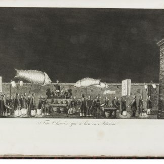
Voyages a Peking, Manille et l'Île de France, fait dans l'intervalle des …Paris, 1808.
€ 15,000.00 -
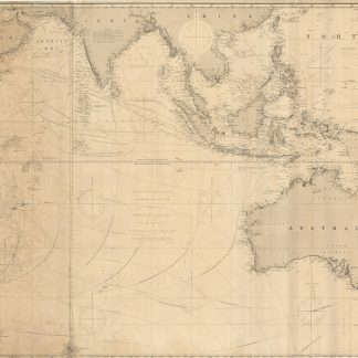
Indian Ocean.London, 1885.
€ 3,000.00 -
Vierzig-Jährige Reise-Beschreibung. Worinnen dessen durch Türkey, Persien, …Nuremberg, 1681.
€ 8,500.00