Der schiffbare Donau-Strom von Ulm bis Pressburg.
[Vienna, Anton Doll, 1830].
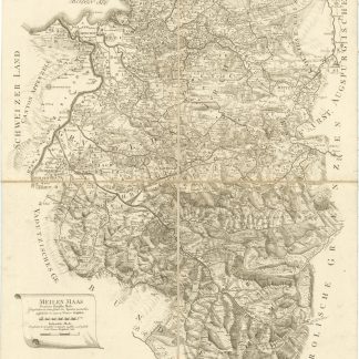
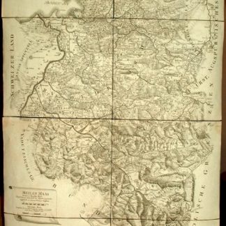
12 lithographed and coloured charts of the Danube by Frühwirth; 11 x 61 cm each. Stored loosely in original cardboard portfolio with letterpress table of contents mounted on cover (413 x 112 mm). Scale ca. 1:150.000 (supplement: ca. 1:185.000).
€ 1,800.00
First edition of this very pretty map showing the Danube from Ulm to Pressburg (charts 1-11), with an extra chart 12 showing the river from its source near Donaueschingen to Ulm. Assembled in a row, the map would measure nearly seven metres in length! Published separately to supplement Anton Gross-Hoffingers "Reisetaschenbuch für Donaufahrer".
Portfolio a little stained; very appealingly preserved.
References
Nebehay/Wagner 212.